Whether you’re looking at taking a whitewater trip to Vancouver Island, or want some new runs to mix things up in winter, this complete kayaking guide is for you.
It is broken up into two main sections: an overview of the paddling regions and top choices from each, and a comprehensive section detailing how to prepare for paddling on the island.
Vancouver Island is a unique paddling destination, at least for Canada, because it goes in winter or anytime there's rain. So if you're looking to paddle year-round on solid whitewater, Vancouver Island should be on your list of destinations!
Each river mentioned below contains a link to Paddling Maps where you can find much more information than is provided here. Paddling Maps is a community-driven initiative to provide beta on rivers around the world.
Vancouver Island Whitewater Kayaking
Vancouver Island Whitewater Kayaking Introduction
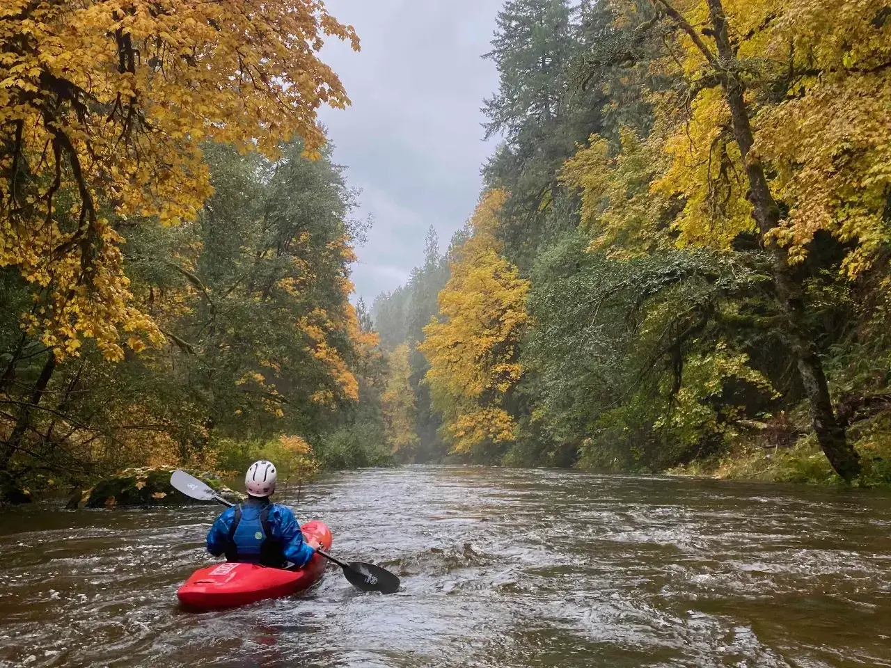
Usually, when the days are getting chilly and the leaves are falling off the trees, most whitewater kayakers in North America are putting their boats into hibernation for the winter.
I’m writing to tell you it doesn’t have to be that way, because there is a mythical place right here in Western Canada, a place where rain falls instead of snow, rivers flow free all winter long, and boats are just waking up from their summer slumber…
This winter whitewater kayaking destination is Vancouver Island. It isn’t a tropical paradise where you can get a sun tan while paddling skin to win in January, but it is a paradise of sorts, one where a drysuit is mandatory, a dryer and hot tub are your best friends, and the worst forecast is really the best forecast.
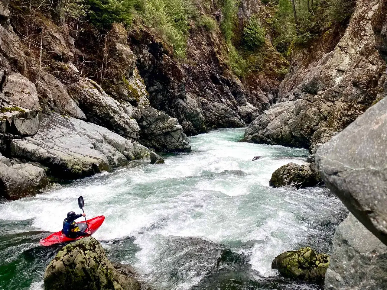
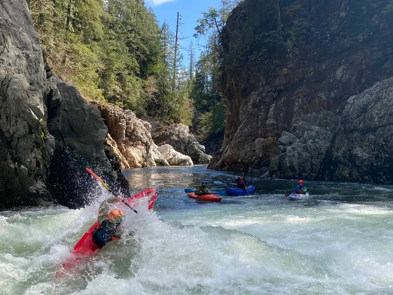
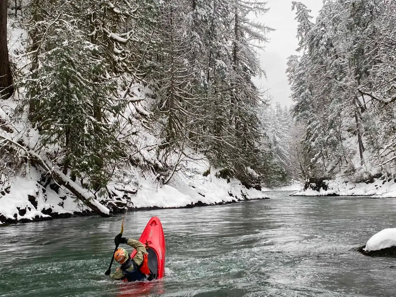
Lower Gordon River (lll) - March
But there’s something to know about the rivers on Vancouver Island–they’re entirely dependent on rain, and that complicates things. So, I’ve put together a brief whitewater kayaking Vancouver Island overview along with nine tips to help ensure your paddling trip is both wet and magical.
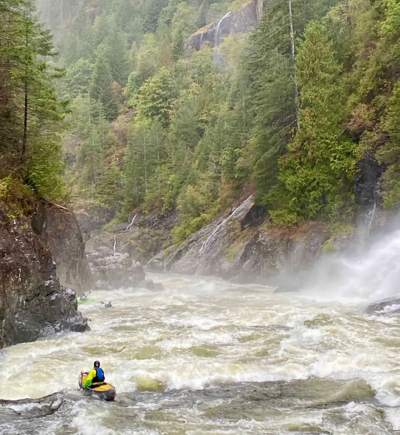
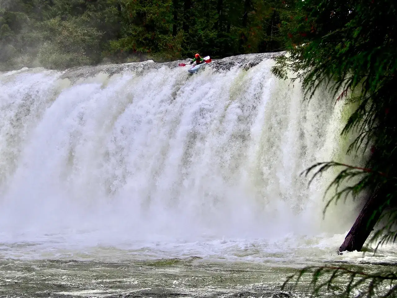
When it rains, it smores...Lower Gold River (lll/lV) - September
In case you haven’t read one of my blarticles before, I’m Koby, part of the Aquabatics Ambassadors Team, and someone who eats sleeps and breathes whitewater kayaking. A few years ago I traded BC Interior ski seasons for Vancouver Island paddling seasons and have never looked back.
How to Get to Vancouver Island
Don’t overthink it. There are two ferry terminals from Vancouver, sailings (trips) run every two hours or so during the day, you don’t need to book unless you want to catch a specific sailing (it’s an extra $20). Fares are about $100 for a car and two passengers one way. Trailers are more money, boats on your roof are not!
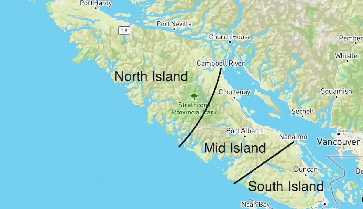
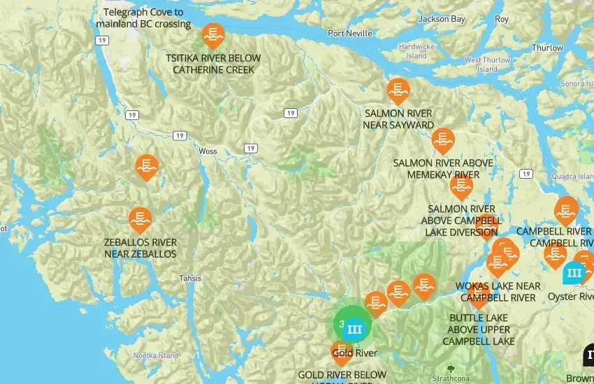
Vancouver Island Kayaking Zones
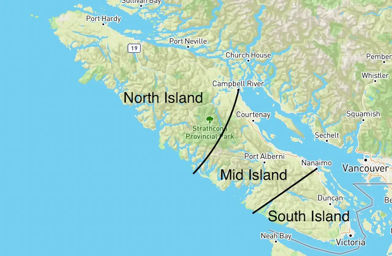
Vancouver Island Zones
I break Vancouver Island down into three kayaking zones based on geographic proximity. Note that these aren’t perfect, I just made them up…but it will make things easier to explain.
Being geographically close to each other means runs in the same zone will very loosely have flows at similar times. It’s also worth noting rivers on the west coast of Vancouver Island always get more rain and thus have far more consistent flows.
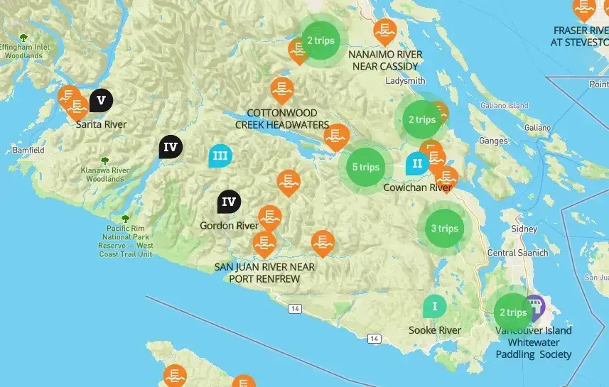
South Vancouver Island Kayaking
Koksilah River (lV) - October
Encompasses every river between Victoria and Nanaimo. Lower elevation drainages often mean better flows mid-winter when things are cold. Most popular rivers in no particular order are the:
Cowichan (II/III)
Koksilah (III/IV)
Chemainus (II/V)
Gordon (III/V)
Nanaimo (III/V).
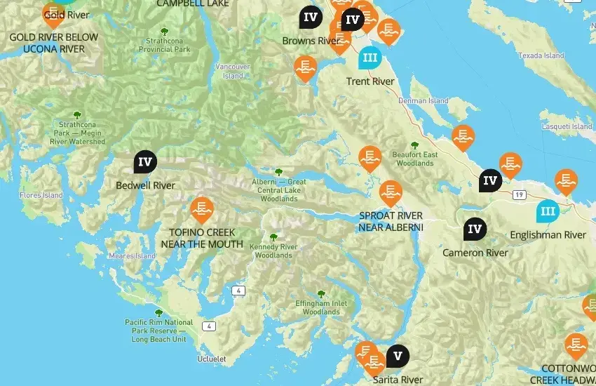
Mid Vancouver Island Kayaking
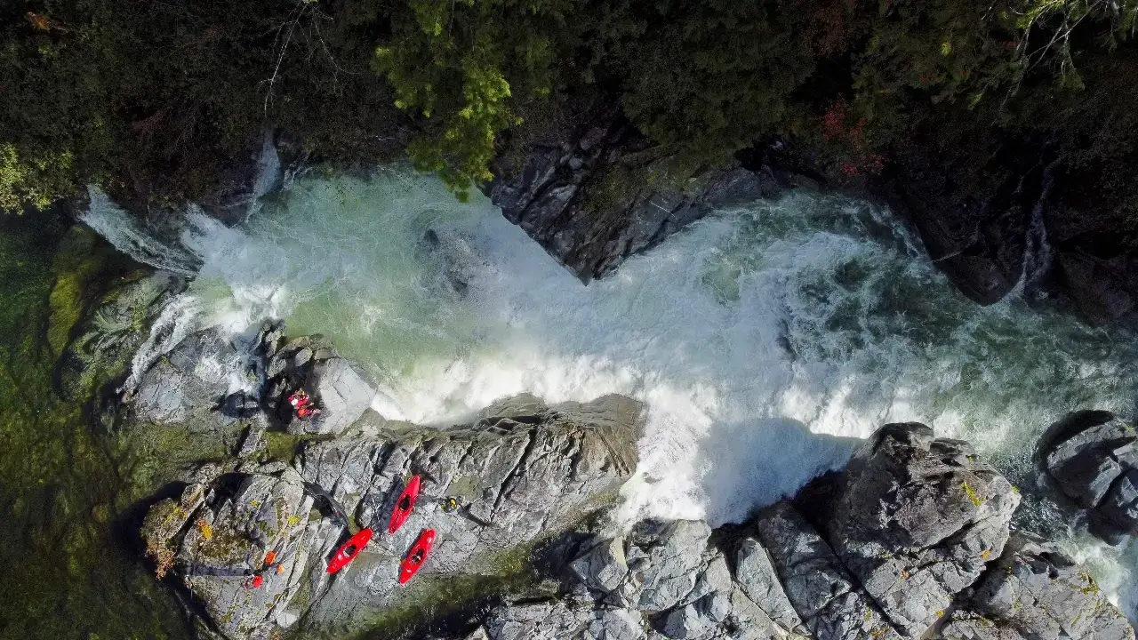
Sarita River (V) - September
Photo Credit: Heather Buckingham
North of Nanaimo to Campbell River. Where Vancouver Island’s mountains start to pop up and cities get further apart. Most popular rivers here are the:
Englishman (II/III)
Cameron (IV)
Sarita (V)
Puntledge (II/V)
Oyster (III)
North Vancouver Island/Beyond Campbell River Kayaking
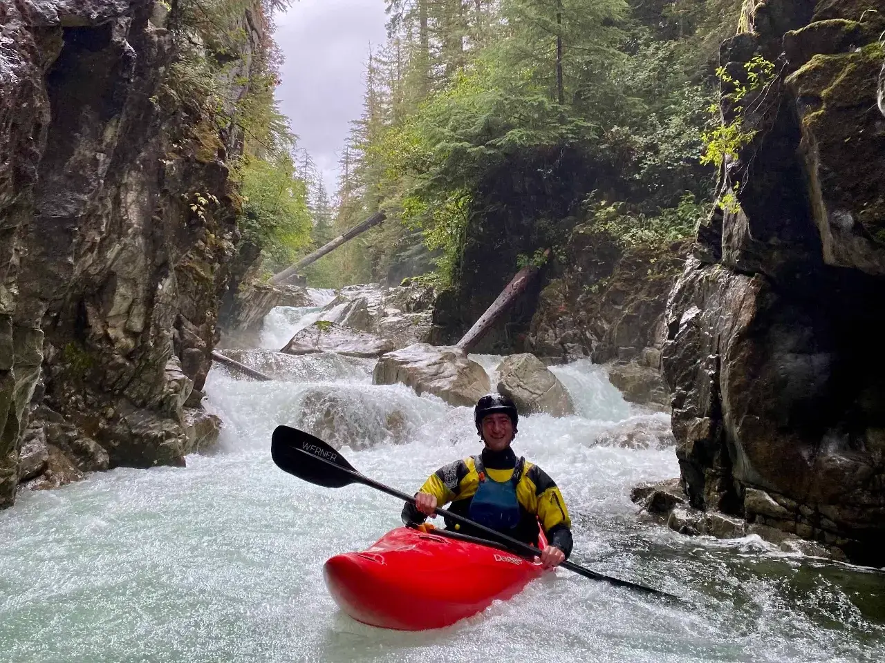
Heber River Canyon (lV) - April
Anything north or west of Campbell River. Being further away from the population centers of the south, these runs are more seldom paddled. It is also the most mountainous region leading to more snow and less rain in the winter, but a freshet (snowmelt) season most springs.
Most popular rivers are the:
Gold and surrounding creeks (II/IV)
White (III/V)
Adam (III/IV)
Nimpkish (III).
River Styles and Difficulty
Every kayaking zone has a huge variety of runs. For example, Sarita (Mexico style waterfalls), the Englishman (cruisey class II/III river running), and the Cameron (class IV granite creeking) are all in the same zone, somewhat close to one another, and are entirely unique rivers. The combination of river density and river variety is one of the best things about kayaking on Vancouver Island.
Tips for Your Vancouver Island Whitewater Kayaking Trip
1 – Be Flexible
Any successful kayaking trip to Vancouver Island requires two key ingredients: warm temperatures (relatively speaking...), and precipitation.
The rainy season on Vancouver Island typically starts in the fall and continues through spring, but there are no fixed rules on when rivers will flow, thus the best strategy is to be as flexible as possible. Planning a trip “sometime this fall/winter/spring” is a far better plan than on any fixed dates (schedules be damned!).
Upper Nanaimo (lV/V) - November
2 - Watch for Warm Wet Weather Trends
Websites and Apps like Windy and SpotWx are your best friends here. They offer multiple forecasts/models on single platforms as well as ten-day weather trends. Keep your eyes open for forecasts with lots of rain and overnight highs a minimum of +4℃.
Keep in mind that above 0℃ at sea level doesn’t mean snow across the entire island, be sure to check forecasts for locations at higher elevations as well! Cowichan Lake is a good forecast for South Island rivers, Port Alberni for Mid-Island stuff and Gold River for the North Island goodies.
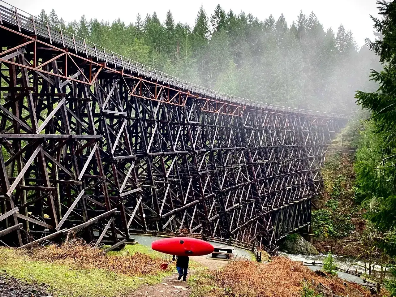
Kinsol Trestle - Koksilah Put-In - December
3 - It Takes Lots of Rain!
How much rain it takes any given river to come up to a good flow is difficult to calculate. It depends largely on local rainfall patterns, freezing levels, and pre-existing ground saturation.
For whitewater kayaking on Vancouver Island, rainfalls greater than 10mm are what is required to bring levels up, and more than 30mm is a nice bet those river juices will be really flowing.
Forecasts that include terminology like “atmospheric river” and “pineapple express” are good signs that should get you very excited! Ultimately, you’re looking for 2-3+ days of consecutive rain with cumulative amounts of over 40mm across multiple forecast models. The question should never be “will it rain?” but rather “how much will it rain?”
And if you’re wondering… following periods of heavy rainfall the rivers usually become too low to paddle in about a week. There are some exceptions to this though, discussed below in tip #7.
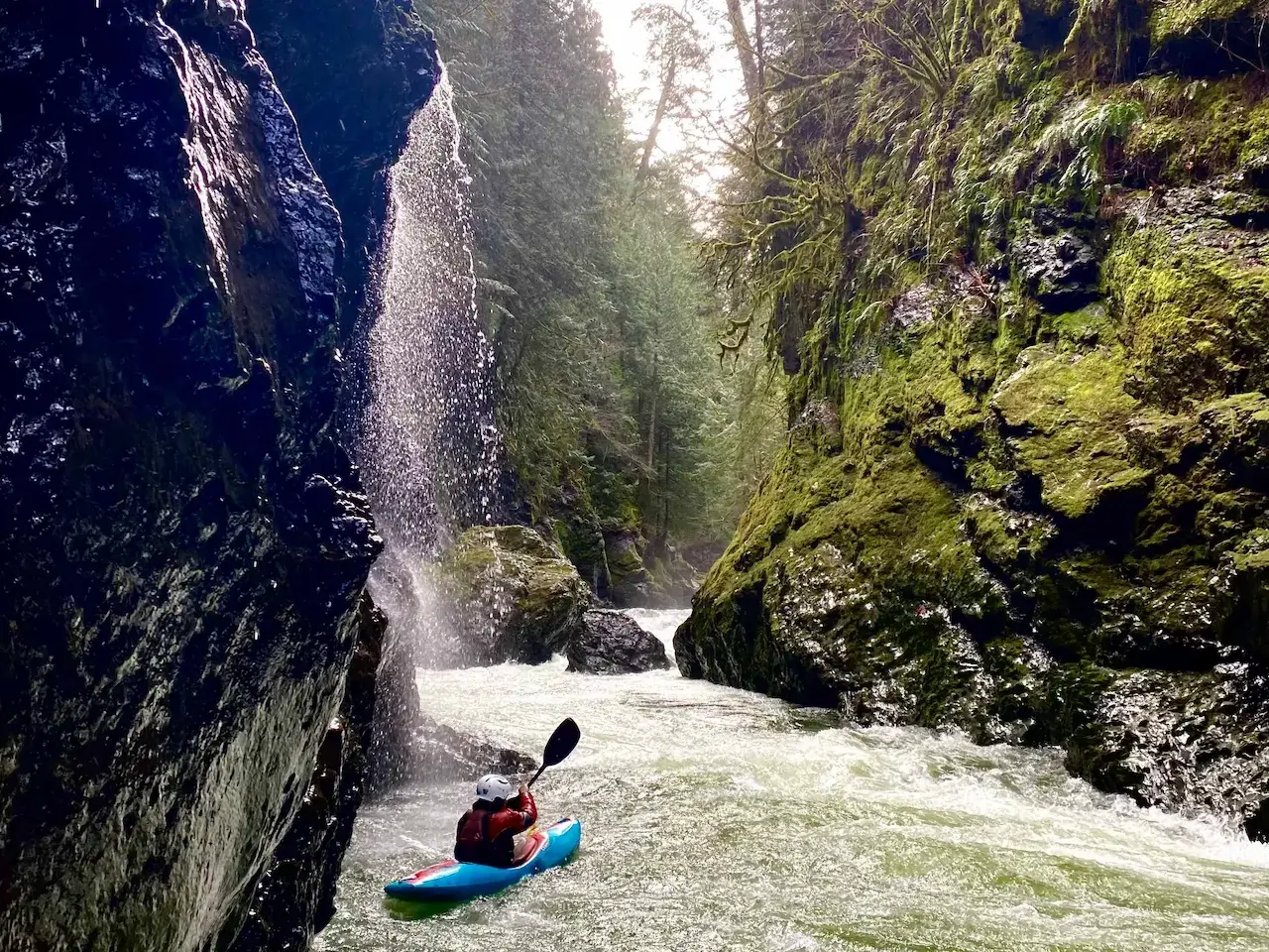
Copper Canyon of the Chemainus River (lV) - February
4 – Which Forecast Locations You Should Check
Vancouver Island is a big place, which means different rivers get different flows every time it rains. I recommend checking multiple forecast models for key locations in each kayaking zone:
For South Vancouver Island Rivers check Cowichan Lake, it gives you a better idea of the temperature and rainfall amounts in the actual river basins around the area. Ocean level forecast can look promising but remember if it’s anywhere close to 0C near the ocean all that rain will be falling as snow further up the basins!
For Mid-Vancouver Island stuff, the Port Alberni and Courtenay forecasts are good options. Taking a rough average between the two will give you the most realistic outlook for flows across the entire zone.
For North Vancouver Island Rivers check the Gold River (Gold River and surrounding creeks) and Sayward (White and Adam rivers) forecasts.
More Lower Gordon Goodies (lll) - April
There’s also a Free Online River Forecast You’ve Never Heard of…
Here’s the link: http://bcrfc.env.gov.bc.ca/freshet/map_clever.html
Take it with a grain of salt, we all know how accurate weather forecasts are and this is a harder thing to forecast that receives way less funding.
6 - Get the Vancouver Island Locals Perspective
The locals know what's up, so you can always just ask them to poo poo any current plans you might be brewing, and if you’re lucky they might confirm you’ve cracked the Vancouver Island Paddling enigma. Introducing yourself on Vancouver Island Whitewater Paddling Societies (VIWPS) Facebook forum is a good place to start networking.
7 – Where’s the River Beta?
https://paddlingmaps.com is your best friend here, but it doesn’t have everything yet (we’re working on it!). A good source to fill in some of the gaps is BC-WW, an old website made by the OG Island Boaters. It is only accessible via the ‘wayback machine’ nowadays though: https://web.archive.org/web/20180823050310/http://www.bc-ww.com/
Grady Ent on Pamela Creek (V) Gold River Area - September
8 - Low Levels Don’t Always Mean Stay Home!
This is the most paradoxical point by far in this blog post, but there’s some truth here… even if the rains have been minimal and river levels are low, South Vancouver Island runs like the Cowichan and Lower Gordon along with North Vancouver Island runs like Gold River often have enough water remaining in them to get a boat down and still have some fun while doing it. Combined with some mountain biking, hiking, skiing, or ocean surfing, Vancouver Island can still provide an awesome holiday when river levels are sub-par, it all just depends on your priorities.
Cowichan River (lll) - February
9 - Go to the Gordon Race
Happening annually in March, the Gordon Race is the BC kayak race/festival most likely to be featured in a future Vice documentary. Kayaking takes place regardless of levels, which have ranged from full-on flood to basically empty in the years past.
But whatever the levels do, the party is one thing that’s been consistently ridiculous every year. Really, you’ll have to go to fully understand everything that is the Gordon Fest, but above all, it truly is a special event in a beautiful part of the world.
Entrance Falls - Middle Gordon (V) - October
Whitewater Kayaking Vancouver Island Summary
So that’s my guide on where to whitewater kayak in and around Vancouver Island! I certainly hope this helps you out next time you feel like getting in your kayak and paddling some awesome whitewater in the middle of winter.
The river’s are varied, and there’s plenty else to do, making Vancouver Island a top choice for a kayaking getaway.
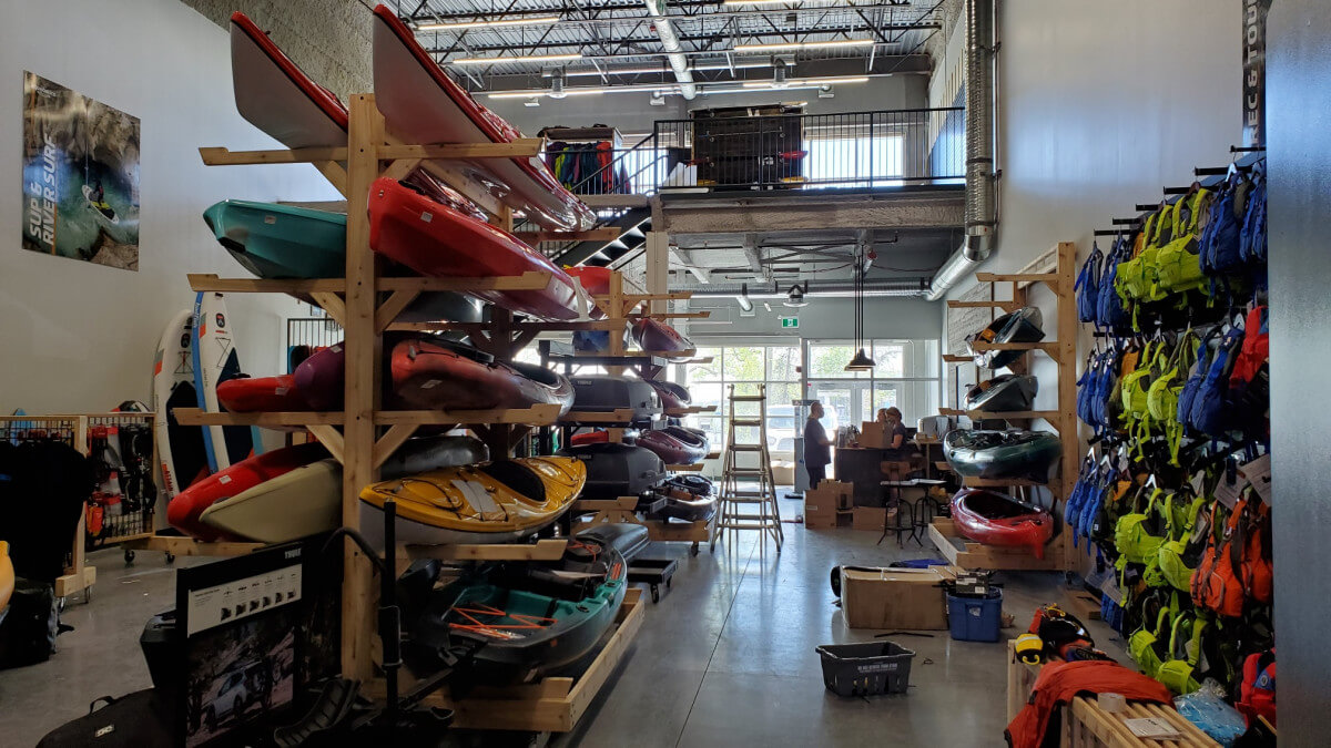
And for all your kayak gear needs, check out AQ Outdoors! If you have any questions, feel free to contact us below or visit us in store.
Other Whitewater Kayaking Vancouver Island Articles
Kayaking Vancouver Island--Gold Area
Kayaking South Vancouver Island
![]()
AQ Outdoors Contact
Edmonton: (p) 780 463-4892 (e) info@aquabaticsedmonton.com
Calgary: (p) 403 288-9283 (e) info@aqoutdoors.com