We’re stoked to announce the launch of our Paddling Maps App!
The app was developed with help from Paddling Magazine, Paddle Alberta, NRS, Kokatat, AQ Outdoors/ Aquabatics and Aquabound.
It was created by Dan and the team at Apero Creative Development.
It is available for iOS right now, and will be released for Android in about 2 weeks.
Paddling Maps
What is Paddling Maps?
Paddling Maps is your all-in-one app for everything you need to know about your next river run:
-
Put in
-
Take out
-
River description
-
River features
-
Ideal water levels
and much more
You can bookmark runs to access them when you’re out of cell service.
This is what the app looks like:

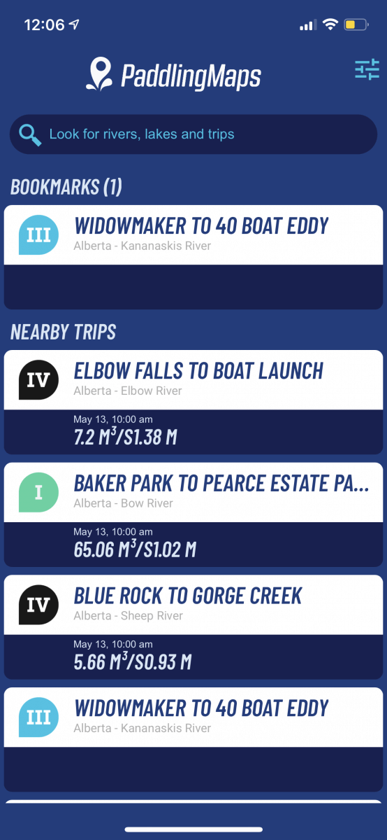

The home screen greets you with nearby runs, and your bookmarked trips.
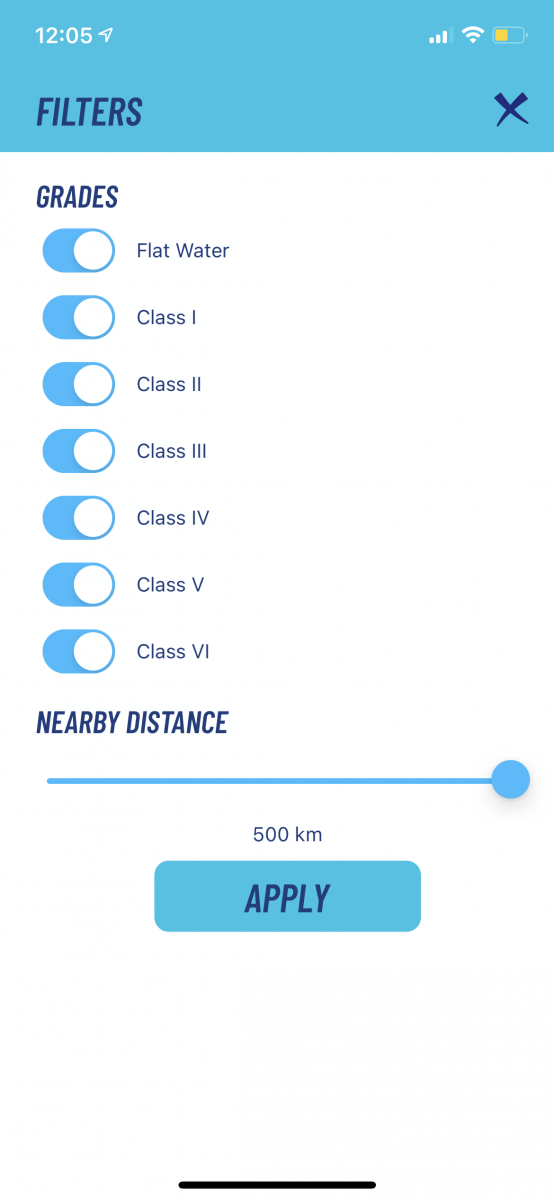
You can customize which class of rivers you want to see, and their distance away from you.
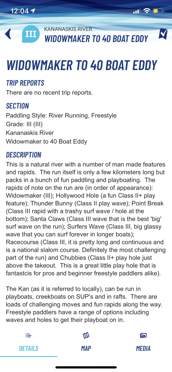
Once you click on a run, you’re taken to an in-depth description of everything you need to know.
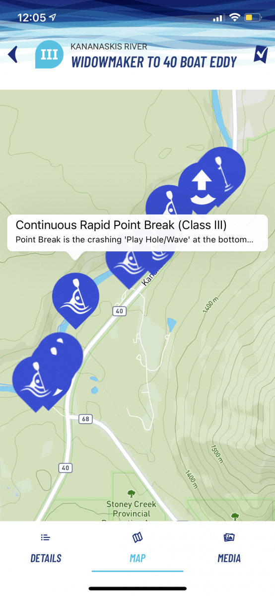
Go to the map to see the put in, take out, and all the major features.
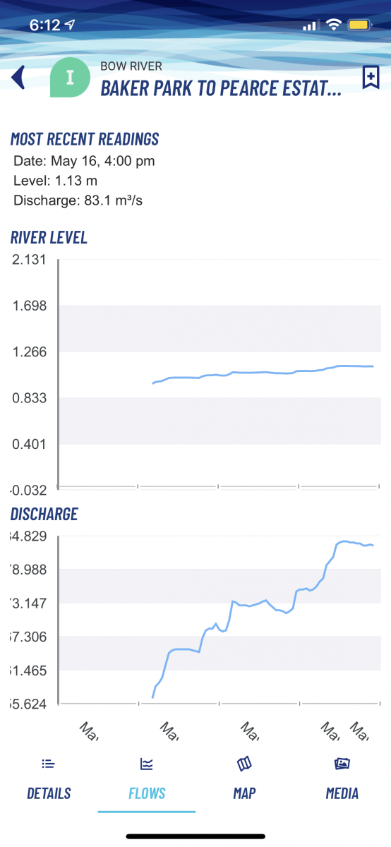
Some runs have a “flows” tab so you can see the current water levels.
Why Choose Paddling Maps?
This is the only app that shows you all the information you need to know about the runs, the water levels, and lets you save them for offline access.
Every river entry is provided by a paddler and vetted by the AQ Outdoors/ Aquabatics team.
This is your complete, all-in-one paddling app by paddlers, for paddlers!
Search Rivers Close to You
Whether you’re on the road travelling to a new place, or want to discover something new where you live, Paddling Maps lets you easily find them!
Set the radius to however far you feel like driving, then scroll through the list of rivers. You can always adjust which river class you’d like to view.
And, you can always search by specific location too, if you need to plan ahead!
Detailed Access Instructions
Knowing how to get to the river, and where to take out, are always important. That’s why the put ins and take outs are marked on every trip report.
Important River Features
The river description in every report provides everything you need to know about the river, run time, shuttle length, and what to expect.
Important river features are also marked on the map, to make sure you know exactly what the descriptions are talking about and to show you exactly where they so you can be prepared.
River Flow
For runs where there is a reliable gauge, river flow information is also included. Charts are provided for both river level and volume, so you can predict if levels are trending up or down and what to expect when you head out.
Everything You Need to Know
Paddling Maps provides all the information you need, from start to finish.
And, it is all accessible on your phone. After you bookmark your favourite runs, or your next trip, you don’t even need cell coverage to view it!
Paddling Maps is the best choice for river reporting, and we hope you try it out soon.
We hope you enjoy the app as much as we do!
It is still brand new, so if you have any questions or concerns, please feel free to contact us:
AQ Outdoors Contact
Edmonton: (p) 780 463-4892 (e) info@aquabaticsedmonton.com
Calgary: (p) 403 288-9283 (e) info@aqoutdoors.com